Florida Gov. Ron DeSantis warns be wary of Hurricane Milton 'wobble' on approach
Published in News & Features
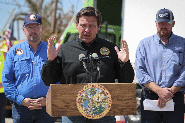
ORLANDO, Fla. — Gov. Ron DeSantis gave a Hurricane Milton update on Tuesday morning, warning Floridians to be wary of shifts in path before landfall.
“Now is the time where you have the ability to make the decisions necessary to keep yourself and your family safe,” he said. “We urge you to execute your plan. Now. Let’s prepare for the worst, and let’s pray that we get a weakening and hope for the least amount of damage is possible, but we must be prepared for a major, major impact to the west coast of Florida.”
He’s spoke from the State Emergency Operations Center in Tallahassee at 7:45 a.m.
“The storm has moved a little bit slower than initially projected. But remember, do not get wedded to the cone,” he said. “Do not get wedded to where the projected landfall is.”
The 5 a.m. advisory has landfall in the Bradenton Beach and Manatee County area, he said.
“You could have a wobble either way. And I think one of the things that’s been good is a lot of those folks down in southwest Florida, like in Lee County and in Charlotte, they’re used to seeing the wobble end up going south, and so you’ve had a lot of people that have evacuated from some of those barrier islands.”
But the range could be north or south of Tampa Bay.
“Wherever it makes landfall, there’s going to be impacts far beyond what the cone actually shows,” he said.
The Florida Division of Emergency Management has close to 1,000 pre-landfall missions underway such as mobile dams, generators, food, water and tarps.
The state has so far deployed more than 11,000 feet of flood protection systems for critical infrastructure such as hospitals, wastewater treatment facilities and electrical infrastructure, he said.
More than 350 ambulances and another 30 paratransits are in operation with another 144 staged if needed.
With mass evacuations from the Gulf Coast underway, gas stations have been running out of fuel, but the state has already begun to deploy emergency supplies since Monday night.
The state still has 268,000 gallons of diesel and 110,000 gallons of gasoline, and another 1.2 million gallons of both diesel and gasoline headed to the state. 27 fuel trucks deployed last night escorted by the Florida Highway Patrol, he said.
“Now there is no fuel shortage. Fuel continues to arrive in the state of Florida by port, and what we’re doing to bring it in on the ground,” he said. “But lines at gas stations have been long. Gas stations are running out quicker than they otherwise would, and so that is causing the state of Florida to help assist with the mission to be able to get fuel to the gas stations so that Floridians have access.”
DeSantis said he hopes 40,000 linemen will be staged to help support power restoration after landfall.
“As most people know, Hurricane Helene left a lot of damage in some of our neighboring states, and there have been a lot of linemen surged into those states, still working on major power restoration,” he said. “So some of these linemen are coming into Florida from as far away as California.”
That includes major help from co-ops and big companies like FPL, TECO and Duke.
“Everybody has is coming together to do what they can to be ready for this potentially very complicated power restoration mission,” he said.
Debris removal efforts, especially in Pinellas and Manatee counties will continue until it’s no longer safe to do so, he said.
“We want to get as much of the debris picked up as is possible,” he said. “We took all state assets that were available throughout the state, took them off their normal missions, and surged them into these affected areas.”
That includes more than 300 dump trucks taking more than 1,200 truckloads of debris, about 22,000 cubic yards, from those areas within the last 48 hours.
“There was a lot of debris. I’d say we’ve made a huge dent in it,” he said. “But I don’t think that even at our current pace, and even if we continue going through Wednesday morning, maybe even Wednesday at noon, that you’re going to be able to get all of it.”
DeSantis said 8,000 National Guard will be activated before landfall. Already on hard are 34 different search and rescue aircraft.
“We’ve never had this many resources prior to a storm,” he said noting the incoming support from other states. “We’ve had a tremendous response from other states, just like we responded to North Carolina when they needed it. States have come to Florida’s aid, and so I just want to thank the states that have stepped up and helped us, whether it’s a Chinook helicopter, whether it’s some search and rescue personnel, you name it, we’ve had a number of states that have stepped up to help us.”
The state has assisted in the evacuation of 202 healthcare facilities, he said.
Also with DeSantis are Florida Division of Emergency Management Director Kevin Guthrie, Florida Department of Transportation Secretary Jared Perdue, Florida Department of Highway Safety and Motor Vehicles Director Dave Kerner and Major General John D. Haas representing Florida’s National Guard.
As of 5 a.m. Tuesday, the National Hurricane Center said Hurricane Milton was a Category 4 hurricane with maximum-sustained winds of 155 mph located 560 miles southwest of Tampa moving east-northeast at 12 mph north of the Yucatan peninsula.
The latest forecast track ranges from Cape Coral in southwest Florida’s Gulf Coast north up to Yankeetown, but the consensus path remains targeted at Tampa Bay with landfall after midnight Thursday still a major Category 3 hurricane with 125 mph winds and 155 mph gusts.
The forecast track has it passing south of Lakeland and Kissimmee headed toward Cape Canaveral never losing hurricane status as it crosses the state into the Atlantic.
Its hurricane-force winds only extend out 30 miles, but tropical-storm-force winds have begun to expand, now out 105 miles.
The forecast shows both hurricane- and tropical-storm-force winds roughly doubling in size by landfall.
In Florida, a hurricane warning is in effect for the west coast from Bonita Beach north to the mouth of the Suwannee River including Tampa Bay, and a hurricane watch for the Dry Tortugas, Lake Okeechobee, the Gulf coast from Chokoloskee to south of Bonita Beach and from the Florida east coast from the St. Lucie/Indian River county line north to the mouth of the St. Mary’s River in Georgia.
Inland hurricane warnings are in place for parts of the southern Florida peninsula including Central Florida’s Lake, Marion, Orange, Osceola, Polk, Seminole and Sumter counties, while Brevard and Volusia counties remain under hurricane watches.
A storm surge warning is in effect for the Gulf coast from Flamingo north to the Suwannee including Charlotte Harbor and Tampa Bay. A storm surge watch is in place on Florida’s east coast from the Sebastian River north to Edisto Beach including the St. Johns River.
Tornadoes could become a threat across the state beginning late Tuesday and into Wednesday, the NHC warned.
“Basically, the entire peninsula portion of Florida is under some type of either a watch or a warning,” DeSantis said.
-------
©2024 Orlando Sentinel. Visit at orlandosentinel.com. Distributed by Tribune Content Agency, LLC.


Comments