More hurricanes are slamming the Gulf Coast. Is this the new normal?
Published in Weather News
Since the turn of the century, major hurricanes hitting the U.S. have had one key feature in common.
Location.
The Gulf of Mexico coastline transformed into a bullseye for major storms, which have taken aim from Corpus Christi, Texas, to Marco Island and destroyed communities in their wake. Eighteen hurricanes reaching Category 3 strength or higher have made landfall along the continental U.S. since 1999.
All but one slammed into the Gulf Coast.
The pattern is even more stark since 2017: All 10 major hurricanes that have made landfall in the U.S. struck communities along the gulf — including six in Florida.
Milton and Helene, occurring not even two weeks apart, are the latest in the streak that’s left Floridians collectively wondering why.
Hurricane experts say storms are growing more intense — and more quickly — largely because of warming seas. Tropical cyclones transform heat from the ocean surface into the movement of winds, so warmer waters allow storms to spin faster.
The Tampa Bay Times reviewed nearly 600 storm tracks and corresponding sea surface temperatures in the Atlantic Ocean basin over the last four decades. Reporters relied on methods used by hurricane researchers to compare storms that underwent rapid intensification — which occurs when maximum wind speeds increase by 35 mph in a day — to ones that didn’t.
The analysis showed that warmer ocean temperatures increase the chances of stronger storms developing by 50%. Most tropical cyclones that have rapidly intensified over the past 40 years have encountered abnormally warm water, the Times found.
In the gulf, that phenomenon means hurricanes can easily become supercharged.
“Anything that gets loose in the gulf is going to basically have double the damage potential it used to, compared to 100 years ago,” said Jeff Masters, a hurricane scientist formerly with the National Oceanic and Atmospheric Administration.
About 3 out of every 4 major hurricanes to form in the Atlantic or the Gulf of Mexico have traveled over record-hot waters. Half of all hurricanes to hit the Gulf Coast over the past 25 years were classified as major storms at landfall.
Weather patterns have also steered storms toward the gulf in recent years, but scientists are unsure whether those forces are natural, fueled by climate change or a mix of both.
Future storms could wreak even more havoc.
Sea-level rise is expected to compound storm surge, inundating communities further inland. Increasing rainfall — both from routine thunderstorms and tropical systems — will saturate the ground, creating an environment ripe for flash flooding.
Already, gulf storms have been devastating, racking up hundreds of billions of dollars in damage and hundreds of lives lost.
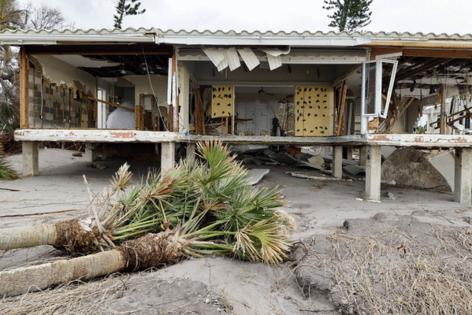
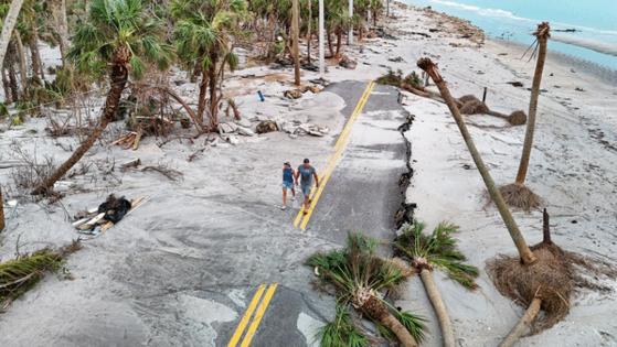
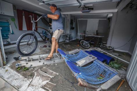
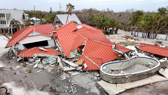
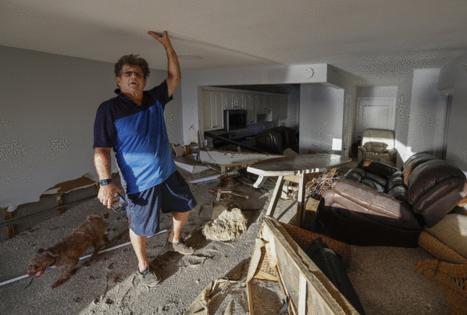
In Florida alone, from Fort Myers Beach to Steinhatchee, flooded homes remain unlivable after Milton and Helene bore their one-two punch. The storms followed Hurricane Idalia, which ravaged the Big Bend in 2023 with a 10-foot storm surge. In the five-year span before that, Ian, Michael and Irma forever transformed stretches of the gulf’s coastline and left dozens dead.
The very geography of the gulf puts communities along its shore at increased risk from strengthening storms.
A hurricane forming in the Atlantic or Caribbean has more open water to tread and fizzle out over. But once storms enter the gulf’s narrow mouth, they have nowhere to go but land.
The only hope is that somehow they’ll weaken.
Why are storms rapidly intensifying?
The gulf is warming at twice the rate of all other global seas and fueling storms like never before.
An ocean heat wave that has decimated South Florida’s coral reefs and powered hyperactive hurricane seasons for at least two summers bears much of the blame for rapid intensification.
“We’re in uncharted territory with ocean temperatures,” said Sam Lillo, a hurricane expert and former research associate with NOAA.
The heat waves are characterized by an ocean area having abnormally high sea surface temperatures, hotter than 90% of historical readings taken at the same place. In the gulf and the Atlantic, they’re a relatively new phenomenon. Widespread heat waves spanning hundreds of miles weren’t recorded until the ‘90s but have become more common.
Since scientists began measuring ocean heat waves, 2 out of every 3 rapidly-intensifying storms went through one of the hot spots, according to the Times analysis of storm paths and water temperature maps from NOAA.
The numbers over the last decade are even more dramatic: All but two storms that rapidly intensified traveled over the unusually warm waters.
In 2017, Hurricane Harvey strengthened from a tropical depression into a Category 4 hurricane just two days before it struck the Texas coast. The monster storm left thousands needing rescue from climbing floodwaters in Houston.
In 2022, Hurricane Ian’s wind speeds nearly doubled within roughly 22 hours before it transformed into a powerful hurricane and made landfall days later in Southwest Florida. The Category 4 storm became the costliest hurricane in state history.
Last month, Hurricane Milton’s winds increased by a staggering 90 mph as it crossed the gulf’s blistering waters just northwest of the Yucatan Peninsula. It leaped from a tropical storm to a Category 5 hurricane in just 24 hours.
Across all the tropical systems that the Times analyzed, the average ocean temperature was approximately 2 degrees Fahrenheit higher in places where storms underwent rapid intensification than in areas where they didn’t. Scientists have found that waters even 1 degree above average could do significant harm to marine life — like coral bleaching.
Nearly half of all Atlantic Category 5 storms recorded over the last 40 years spawned in the last decade. Most weakened before making landfall, but every one underwent a rapid intensification cycle.
Four out of every 5 storms that reached Category 5 intensity encountered record-hot waters.
“It’s quite possible we’ve entered a new era of increased hurricane activity in the Gulf of Mexico,” said Masters, the hurricane scientist. “And certainly, we have reached a new era of activity for more intense storms.”
Experts say that this type of strengthening isn’t a new phenomenon. But if waters continue to get warmer, the chance of a storm crossing a heat wave during its lifetime increases.
Over the last quarter-century, rapid intensification has clustered in the gulf
“It’s a matter of shifting the windows of opportunity and widening them,” Lillo said.
While ocean temperatures are a primary source of hurricane fuel, it’s not clear whether they cause more hurricanes. Only that they make powerful storms more likely.
Why are storms targeting the Gulf Coast?
A flurry of deadly and damaging hurricanes during the mid-2000s made gulf storms like Katrina and Charley household names. During those summers, water temperatures were close to normal and the string of storms didn’t last as long.
Angry tropics calmed for about a decade, until 2017, when Harvey and Irma hit the Gulf Coast with ferocious intensity. That kicked off an eight-year streak of major gulf landfalls — an unprecedented frequency.
The last similar period was between 1945 and 1950, when five major hurricanes hit South Florida.
“That’s the only comparable beating that we’ve taken in history,” Masters said. “And that wasn’t nearly as severe as what we endured the last eight years.”
Hurricane experts have theories about why recent landfalls have clustered along the gulf.
Research has linked major weather patterns to tropical activity, which explains why hurricanes make landfall more often during some seasons, climatologists say.
For example, the El Niño-Southern Oscillation is a natural climate pattern that influences water temperature and air pressure over the tropical Pacific Ocean. It has three phases that shift irregularly every two to seven years — El Niño, La Niña and a neutral phase transitioning between the two.
El Niño cycles typically bring warmer waters but damper storm formation and intensification. A La Niña has the opposite effect and is associated with less dry air and less wind shear to tear down hurricane strength.
El Niño and La Niña patterns also influence wind flows that control hurricane paths across the Atlantic. The jet stream, one such wind pattern, shifts north during a La Niña and steers hurricanes toward U.S. landfall.
To the surprise of several scientists, the Atlantic basin has suffered under frequent and lengthy La Niña cycles in recent years — all but two of the last seven seasons.
That’s created more favorable hurricane conditions and winds that push more storms toward the gulf.
Adam Sobel, a climatologist with Columbia University, predicted eight years ago that El Niño phases, which are correlated with milder hurricane seasons, would dominate the next decade.
When the opposite happened, Sobel and other researchers couldn’t explain why.
“We’re in a period now of deep uncertainty,” he said.
It’s too soon to pin the unexpected shift on a warming world. Eight years is not enough time to draw definitive conclusions, according to scientists. But climate change will mimic the effects of strong La Niña phases and could make gulf landfalls more likely, said Lillo, the former research associate with NOAA.
“We don’t know how hurricane tracks are going to change with a changing climate,” Masters said. “Just that they will.”
Predicting where a storm will hit even days before landfall is hard enough for forecasters, so anticipating landfall patterns over a season or decade is nearly impossible, experts said.
It’s unclear how long the gulf streak could continue, but Masters said he isn’t convinced it signals a “new normal.” It wasn’t too long ago that Florida went a decade without a single hurricane strike, from 2006 to 2015, he said.
The gulf may not remain a magnet. But another La Niña cycle is expected to begin before November ends.
How will a warming climate affect hurricane intensity?
Hurricanes are largely considered random events, but experts are confident that tropical cyclones will become more intense and wetter in a warmer world.
Climate change is already making water, the biggest killer during tropical systems, more deadly, said David Keelings, a University of Florida professor who researches climate extremes.
Storm surge is compounded by rising seas and hurricane wind speeds. Florida’s west coast is projected to see more than 1-foot of sea-level rise by 2050.
That’s a best-case scenario. And it could still put thousands more at risk of surge, including people who don’t live in evacuation zones.
During Hurricane Helene, nearly 1 in 10 properties in Pinellas County were set for serious flooding, the Times found. A future storm with similar surge potential — coupled with higher seas — would be even more devastating.
An increasingly warmer atmosphere traps more moisture, making hurricanes rainier. That can lead to extensive inland flooding.
Keelings has documented an alarming trend over the last 50 years: Rainfall flooding from tropical cyclones is killing more people than wind and storm surge. In the past decade, rainfall flooding caused nearly 60% of all U.S. hurricane deaths, scientists with the National Hurricane Center similarly found.
Predicted surge levels serve as the basis for evacuation orders. But inland flash flooding can catch people off-guard, inundating areas that don’t normally flood.
Recent storms provide tragic examples.
Hurricane Helene killed 198 people across the Carolinas and Georgia, largely from rainfall flooding. Twenty people died in Florida, where surge crashed up and down the Gulf Coast as the storm made landfall in the Big Bend.
A wetter atmosphere also means rainfall is expected to continue to increase overall in Florida, not just during hurricanes, Keelings said. He looked at the frequency of extreme rain events from 1950 through 2016 and found that Florida experienced an increase of about 25 more each year.
Soils that become more saturated by the end of these extreme rainy seasons could ripen conditions for dangerous flooding.
Milton’s hurricane-force winds ripped trees from already soggy soils, but its historic rain also flooded neighborhoods that had never experienced waters so high.
About 17 inches of rain drenched parts of Pinellas and Hillsborough counties in just five hours, submerging inland neighborhoods.
In Clearwater, residents were pulled from an apartment complex under 6 feet of water. Milton’s heavy rains caused stormwater pumps to fail in some North Tampa neighborhoods, where lakes overflowed and crept inside homes.
The rain reached 1-in-1,000-year levels.
Masters, the former NOAA scientist, said expectations about how climate change will shape future hurricane seasons can be boiled down to a simple concept: “The extremes will get more extreme.”
Waters are getting hotter. Storms are getting wetter. Combined, experts say, that means hurricanes could continue to feel more routine — and also more formidable.
This story was produced in partnership with the Florida Climate Reporting Network, a multi-newsroom initiative founded by the Miami Herald, the South Florida Sun Sentinel, The Palm Beach Post, the Orlando Sentinel, WLRN Public Media and the Tampa Bay Times.
©2024 Miami Herald. Visit at miamiherald.com. Distributed by Tribune Content Agency, LLC.


Comments