Hurricane Milton remains powerful Category 5 storm with 165 mph winds on way to Florida
Published in Weather News


ORLANDO, Fla. — Hurricane Milton began its turn toward Florida on Tuesday rebounding back to Category 5 strength with a forecast landfall on the Gulf Coast south of Tampa Bay still as a major hurricane and the threat of 15-foot storm surge, according to the National Hurricane Center.
“Stronger vertical shear is expected to set in about 24 hours, but even if this causes some weakening, it will not be enough to keep Milton from being an extremely dangerous hurricane when it reaches shore.” said NHC Warning Coordination Meteorologist Robbie Berg.
The powerful hurricane surged Monday into a monster Category 5 storm with 180 mph winds in the Gulf of Mexico, but lost some steam overnight as it moved over the waters just north of Mexico’s Yucatan Peninsula, falling to 145 mph winds earlier Tuesday.
As of 8 p.m. Eastern time, though, the NHC said Milton had remained at a formidable Category 5 strength with maximum-sustained winds at 165 mph located 440 miles southwest of Tampa and 280 miles west-southwest of the Dry Tortugas moving east-northeast at 10 mph.
The state earlier Tuesday had its first of what could be many tornado warnings ahead of landfall, with the National Weather Service saying an observed tornado was approaching Marco Island in southwest Florida with a warning that lasted until 1:30 p.m.
The latest forecast track ranges from Cape Coral in southwest Florida’s Gulf Coast north up to near Hernando Beach, but the consensus path remains targeted south of Tampa Bay near Sarasota with landfall late Wednesday or after midnight Thursday still a major Category 3 hurricane with 125 mph winds and 155 mph gusts.
“It is still critical to remember that even at 36 hours (around the time of potential landfall), NHC’s track forecasts can be off by an average of 60 nautical miles, which means we still can’t pinpoint an exact landfall location, especially if additional wobbles occur in the short term,” Berg said.
A strike on Tampa Bay could bring devastating storm surge, something the area endured already with Hurricane Helene less than two weeks ago with deadly results.
“Milton has the potential to be one of the most destructive hurricanes on record for west-central Florida,” said NHC senior hurricane specialist John Cangialosi.
The area has not been directly hit by a major hurricane since 1921.
“Hurricane Helene was a water event, and that was devastating for portions of our community, especially those along our waterways, which are 126 miles worth of waterfront property in our community,” Tampa Mayor Jane Castor said Tuesday. “Milton has a possibility of bringing close to twice the amount in storm surge, hurricane force, Category 3 or 4 winds and a great deal of rain on our already saturated community. So we can’t ask you in any other way to please be prepared.”
She urged all in evacuation zones to leave now.
“You want to pick a fight with Mother Nature. She’s winning 100% of the time, and individuals that are in these — say you’re in a single-story home — 12 feet is above that house. So if you’re in it, basically, that’s the coffin that you’re in.”
The forecast track has shifted south as of 5 p.m., now projecting it to pass through southern Polk and Osceola counties as a Category 2 hurricane with 100 mph sustained winds and 120 mph gusts before heading toward southern Brevard County near Melbourne, but never losing hurricane status as it crosses the state into the Atlantic.
Its hurricane-force winds only extend out 30 miles, but tropical-storm-force winds have continued to expand Tuesday, now out 140 miles.
“Milton’s wind field is expected to expand as it approaches Florida. In fact, the official forecast shows the hurricane and tropical-storm-force winds roughly doubling in size by the time it makes landfall,” Berg said. “Therefore, damaging winds, life-threatening storm surge, and heavy rainfall will extend well outside the forecast cone.”
In Florida, a hurricane warning is in effect for the west coast from Bonita Beach north to the mouth of the Suwannee River including Tampa Bay and on the east coast from the St. Lucie/Martin county line north to Ponte Vedra Beach.
Inland hurricane warnings are in place for parts of the southern Florida peninsula including Central Florida’s Brevard, Lake, Marion, Orange, Osceola, Polk, Seminole, Sumter and Volusia counties.
Hurricane watches are in place for the Dry Tortugas, Lake Okeechobee, the Gulf coast from Chokoloskee to south of Bonita Beach and on the east coast from Florida east coast north of Ponte Vedra Beach to the mouth of the St. Mary’s River and from the St. Lucie/Martin county line to the Palm Beach/Martin county line.
A storm surge warning is in effect for the Gulf coast from Flamingo north to the Suwannee including Charlotte Harbor and Tampa Bay and on Florida’s east coast from the Sebastian Inlet north to the mouth of the St. Mary’s River including the St. Johns River.
A tropical storm warning is in effect for all of the Florida Keys, Dry Tortugas, Florida Bay, Lake Okeechobee, the Gulf coast from Flamingo to south of Bonita Beach and from north of the mouth of the Suwannee River to Indian Pass, and on the Florida east coast south of the St. Lucie/Indian River county line south to Flamingo and north of Ponte Vedra Beach north to Altamaha Sound, Georgia.
Tornadoes could become a threat across the state beginning late Tuesday and into Wednesday, the NHC warned.
Updated storm surge predictions now call for 10-15 feet from the Anclote River north of Tampa south down to Englewood including Tampa Bay in the core projected landfall area.
“We’re talking about storm surge values higher than the ceiling,” said Florida Division of Emergency Management Director Kevin Guthrie. “Please. If you’re in the Tampa Bay area, you need to evacuate. If they have called for your evacuation order, I beg you, I implore you, to evacuate. Drowning deaths due to storm surge are 100% preventable if you leave.”
Evacuations on much of Florida’s west coast barrier islands have already begun.
“We had situations where people died of drowning in Hurricane Ian. Had they just gone across the bridge from Estero Bay, Sanibel Island and so on, just across the bridge to the first available shelter that had capacity, they’d still be alive today,” he said.
The NHC also warns 6-10 feet could be seen from Englewood south to Bonita Beach including Charlotte Harbor, 5-10 feet from the Anclote River north to Yankeetown, 4-7 feet from Bonita Beach south to Chokoloskee, 3-5 feet from Yankeetown north to the Suwannee River and on the east coast from the Flagler/Volusia county line north to Altamaha Sound, Georgia. The NHC also forecasts 2-4 feet from Sebastian Inlet north to the Volusia/Flagler line and from Altamaha Sound north to Edisto Beach, South Carolina, the Dry Tortugas and St. Johns River.
Rainfall predictions also have increased with the NHC expecting 5-12 inches with some areas getting as much as 18 inches across Central Florida and portions of North Florida through Thursday.
“This rainfall brings the risk of life-threatening flash, urban and aerial flooding along with moderate to major river flooding,” the NHC warned.
It’s forecast to continue its turn to the east-northeast Tuesday and Wednesday and approach Florida’s Gulf Coast by Wednesday night.
“The storm has moved a little bit slower than initially projected. But remember, do not get wedded to the cone,” said Gov. Ron DeSantis during a Tuesday morning press briefing. “Do not get wedded to where the projected landfall is.”
“You could have a wobble either way. And I think one of the things that’s been good is a lot of those folks down in southwest Florida, like in Lee County and in Charlotte, they’re used to seeing the wobble end up going south, and so you’ve had a lot of people that have evacuated from some of those barrier islands.”
But the range could be north or south of Tampa Bay.
“Wherever it makes landfall, there’s going to be impacts far beyond what the cone actually shows,” he said.
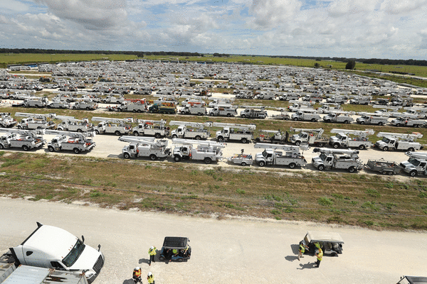
The Florida Division of Emergency Management has close to 1,000 pre-landfall missions underway such as mobile dams, generators, food, water and tarps.
The state has so far deployed more than 11,000 feet of flood protection systems for critical infrastructure such as hospitals, wastewater treatment facilities and electrical infrastructure, he said.
More than 350 ambulances and another 30 medical transport vehicles are in operation with another 144 staged if needed.
With mass evacuations from the Gulf Coast underway, gas stations have been running out of fuel, but the state has already begun to deploy emergency supplies since Monday night.
The state still has 268,000 gallons of diesel and 110,000 gallons of gasoline, and another 1.2 million gallons of both diesel and gasoline headed to the state. 27 fuel trucks deployed last night escorted by the Florida Highway Patrol, he said.
“Now there is no fuel shortage. Fuel continues to arrive in the state of Florida by port, and what we’re doing to bring it in on the ground,” he said. “But lines at gas stations have been long. Gas stations are running out quicker than they otherwise would, and so that is causing the state of Florida to help assist with the mission to be able to get fuel to the gas stations so that Floridians have access.”
DeSantis said he hopes 40,000 linemen will be staged to help support power restoration after landfall.
“As most people know, Hurricane Helene left a lot of damage in some of our neighboring states, and there have been a lot of linemen surged into those states, still working on major power restoration,” he said. “So some of these linemen are coming into Florida from as far away as California.”
That includes major help from co-ops and big companies like FPL, TECO and Duke.
“Everybody has is coming together to do what they can to be ready for this potentially very complicated power restoration mission,” he said.
Debris removal efforts, especially in Pinellas and Manatee counties will continue until it’s no longer safe to do so, he said.
“We want to get as much of the debris picked up as is possible,” he said. “We took all state assets that were available throughout the state, took them off their normal missions, and surged them into these affected areas.”
DeSantis said 8,000 National Guard members would be activated before landfall. Already on hard are 34 different search and rescue aircraft.
“We’ve never had this many resources prior to a storm,” he said noting the incoming support from other states. “We’ve had a tremendous response from other states, just like we responded to North Carolina when they needed it. States have come to Florida’s aid, and so I just want to thank the states that have stepped up and helped us, whether it’s a Chinook helicopter, whether it’s some search and rescue personnel, you name it, we’ve had a number of states that have stepped up to help us.”
The state has assisted in the evacuation of 202 health care facilities, he said.
“Now is the time where you have the ability to make the decisions necessary to keep yourself and your family safe,” he said. “We urge you to execute your plan. Now. Let’s prepare for the worst, and let’s pray that we get a weakening and hope for the least amount of damage is possible, but we must be prepared for a major, major impact to the west coast of Florida.”
Evacuation efforts have congested highways to the point the state has dropped all tolls in west and Central Florida and Alligator Alley. It has also opened up the shoulders on sections of Interstate 4 and 75, cleared by the state Department of Transportation, to assist in the evacuation.
“This is not a good situation. It is a very serious situation,” said National Weather Service Director Ken Graham on Monday afternoon. “We’ve got aircraft, both at NOAA and the hurricane hunters at the Air Force constantly in this storm to get us the latest readings as we track intensification. Things change real quick on us.”
He said he expects the wind field to expand as it approaches the coast.
“I really want to urge everybody, this is really important. I’ve seen this before,” he said. “Even if you have fluctuations in the maximum wind speed, because the winds come down a little bit before landfall, we’re still talking a major hurricane. Expect the wind field to expand. That means more storm surge and more areas that could see the significant wind damage.”
It had rapidly grown from a tropical storm with 50 mph winds Sunday morning to a Category 5 hurricane to 180 mph winds by Monday evening, an increase 130 mph in intensity in just under 36 hours.
Only Hurricane Wilma in 2005 and Hurricane Felix in 2007 had more rapid intensification among NHC records.
Colorado State University meteorologist Phil Klotzbach said this is the latest in the calendar year ever for a Category 5 hurricane with at least 175 mph winds on record. He said it was the strongest in the Gulf of Mexico since 2005’s Hurricane Rita.
It’s also only the second October Category 5 hurricane in the satellite era since 1966 he said after 2018’s Hurricane Michael.
The Federal Emergency Management Agency announced President Joe Biden had authorized FEMA to coordinate all disaster relief efforts in the state and approved 75% federal funding for emergency protective measures including direct federal assistance to 37 counties that were part of DeSantis’ original emergency declaration request, and the same level limited to direct federal assistance to an additional 14 counties. On Tuesday, Biden expanded the emergency declaration to the Seminole Tribe of Florida.
“The president has approved what we asked for. We’re thankful for that,” DeSantis said Monday afternoon. “If there’s something we need that they don’t approve, I will not hesitate to call him. We want to use whatever resources are available to be able to help Floridians prepare and respond to this storm. But everything we’ve asked for from President Biden, he has approved, and we do think we’ll get more approvals for some of the individual assistance and the debris removal after landfall.”
DeSantis had declared a state of emergency for 51 of the state’s 67 counties, up from 34 declared on Saturday.
The updated list includes Alachua, Baker, Bradford, Brevard, Broward, Charlotte, Citrus, Clay, Collier, Columbia, DeSoto, Dixie, Duval, Flagler, Gilchrist, Glades, Hamilton, Hardee, Hendry, Hernando, Highlands, Hillsborough, Indian River, Lafayette, Lake, Lee, Levy, Madison, Manatee, Marion, Martin, Miami-Dade, Monroe, Nassau, Okeechobee, Orange, Osceola, Palm Beach, Pasco, Pinellas, Polk, Putnam, Sarasota, Seminole, St. Johns, St. Lucie Sumter, Suwanee, Taylor, Union, and Volusia counties.
Disney, Universal, SeaWorld, Legoland and Kennedy Space Center Visitor Complex were among all the theme parks and attractions that will be closed Wednesday and Thursday.
In Central Florida, UCF and Valencia State College canceled classes Tuesday-Thursday while Rollins canceled classes for the whole week. Orange, Lake, Osceola and Volusia counties had announced closures as well for Wednesday and most on Thursday.
SunRail announced it would shut down beginning Tuesday and remain closed through at least Thursday depending on the storm impact.
Commercial operations at both Orlando International Airport and Orlando Executive Airport will cease beginning Wednesday morning, although both airports will remain open for emergency use. Orlando Sanford International Airport also announced Tuesday it would cease operations Wednesday. Daytona Beach International Airport will shut down as of 10 a.m. Wednesday.
“Put your hurricane preparedness plan in place, make sure your gas tanks are filled,” DeSantis said on Sunday. “Make sure you have enough water and nonperishable food to last you as long as the power may be out, clear up loose objects in your yard. Obviously, the big debris piles, you need that to get hauled away. But anything other than that that isn’t debris,” he said.
Impacts on Florida will include storm surge and heavy rains with 5-10 inches and some areas up to 15 inches forecast for portions of the Florida peninsula and Florida Keys through Wednesday night.
“This rainfall brings the risk of flash, urban, and areal flooding, along with minor to isolated moderate river flooding,” the NHC stated.
Much of the state including all of Central Florida remains under a flood watch from Sunday though Thursday, according to the National Weather Service.
“Excessive runoff may result in flooding of rivers, creeks, streams, and other low-lying and flood-prone locations,” the NWS advisory states. “Flooding may occur in poor drainage and urban areas.”
Tampa Bay and the rest of the Gulf Coast of the state just endured major storm surge and wind damage from Hurricane Helene less than two weeks ago.
In addition, swells generated by the system will begin to hit the southwestern Gulf of Mexico coast Tuesday, spreading to the north and east by early next week.
The National Weather Service in Melbourne has all of Central Florida under either hurricane warnings or watches and flood watches as of Tuesday morning.
“Major Hurricane Milton will bring the potential for strong to damaging winds, considerable rainfall flooding, a few tornadoes, and battering surf and coastal flooding along portions of the coast,” said NWS meteorologist Tim Sedlock. “Conditions will deteriorate Wednesday and Wednesday night and linger through Thursday.”
The Space Force’s Space Launch Delta 45 late Saturday put Cape Canaveral Space Force Station and Patrick Space Force Base under HURCON 2 predicting surface winds in excess of 58 mph within 24 hours.
“Forecasts show Milton is expected to be a Category 1 hurricane when it arrives in our area,” said SLD 45 public affairs media chief Emre Kelly. “While the anticipated impacts of this storm are not driving a mandatory evacuation, we do expect downed trees, power outages, possible cell service outages, and localized flooding. Evacuation of nonessential personnel and families is voluntary.”
The U.S. Coast Guard has set Port Canaveral’s port condition to “YANKEE,” meaning sustained gale-force winds are expected within 24 hours. It remains open with limited operations, but preparing for closure of waterside and vessel shoreside port operations. Jetty Park is closed until further notice.
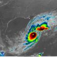
The NHC also is keeping track of Hurricane Leslie in the Atlantic, that grew back to hurricane strength late Tuesday.
As of 5 p.m. Tuesday, Leslie was located about 1,490 miles west-northwest of the southernmost Cape Verde Islands moving northwest at 14 mph with maximum sustained winds of 75 mph returning it to Category 1 strength after having diminished to a tropical storm most of Tuesday.
“This general motion is expected to continue through Wednesday, followed by a turn to the north Wednesday night and to the northeast by Friday,” forecasters said. “Little change in strength is expected through Wednesday night. Weakening is expected to begin Thursday.”
The NHC also has its eyes on a tropical wave expected to move off the west coast of Africa in the next few days and a system that dropped rain over South Florida on Monday.
The 2024 Atlantic hurricane season has had 13 named storms including nine hurricanes, four of which grew to major hurricane strength, and four tropical storms.
Hurricane season runs from June 1-Nov. 30.
-------
©2024 Orlando Sentinel. Visit at orlandosentinel.com. Distributed by Tribune Content Agency, LLC.


Comments