2024’s violent tornado season has been one of the most active on record − a meteorologist explains the weather behind the outbreaks
Published in Science & Technology News


Spring 2024 was unnerving for people across large parts of the U.S. as tornado warnings and sirens sent them scrambling for safety.
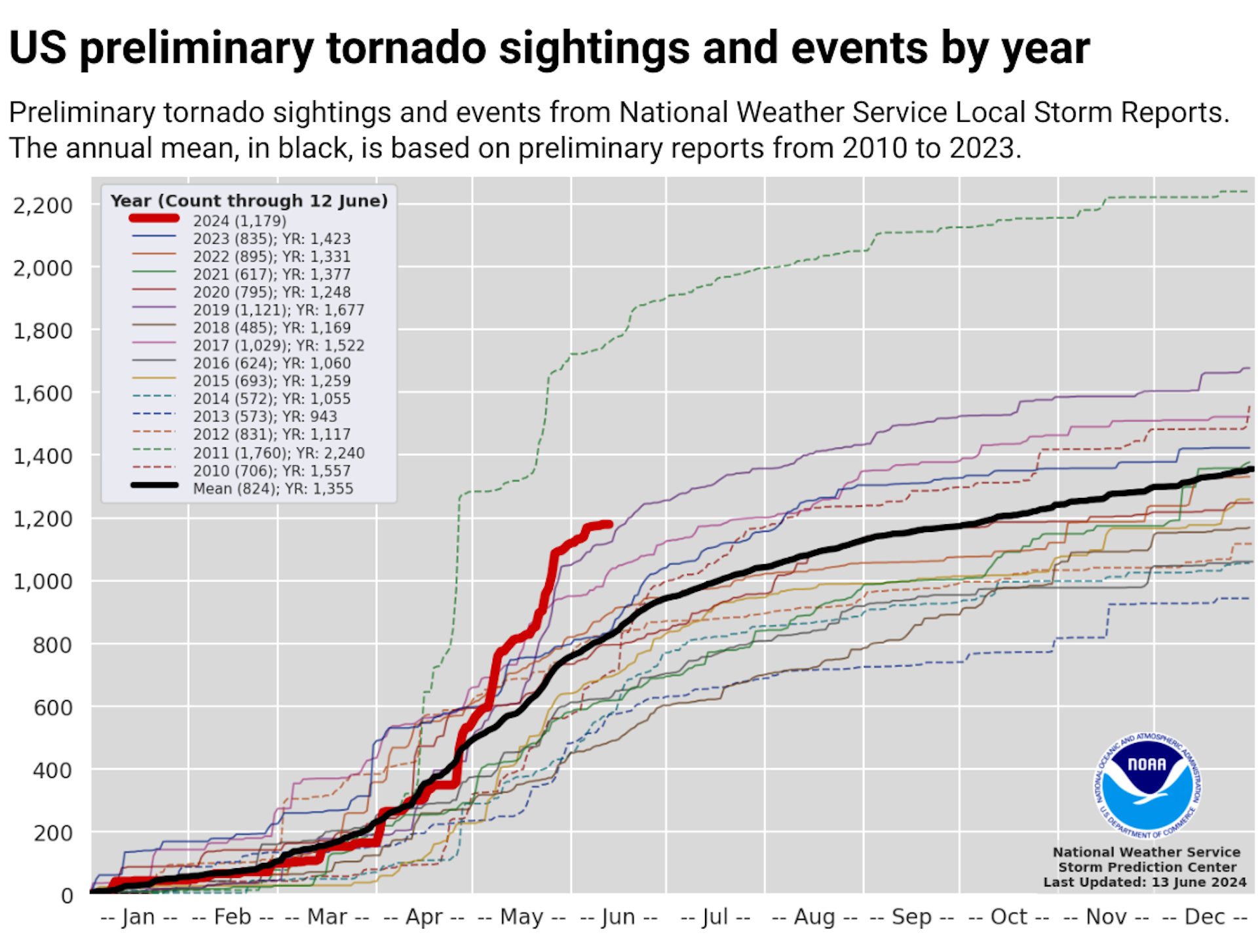
More than 1,100 tornadoes were reported through May − a preliminary number but nearly twice the 30-year average at that point and behind only 2011, when deadly tornado outbreaks tore across the southeastern U.S.
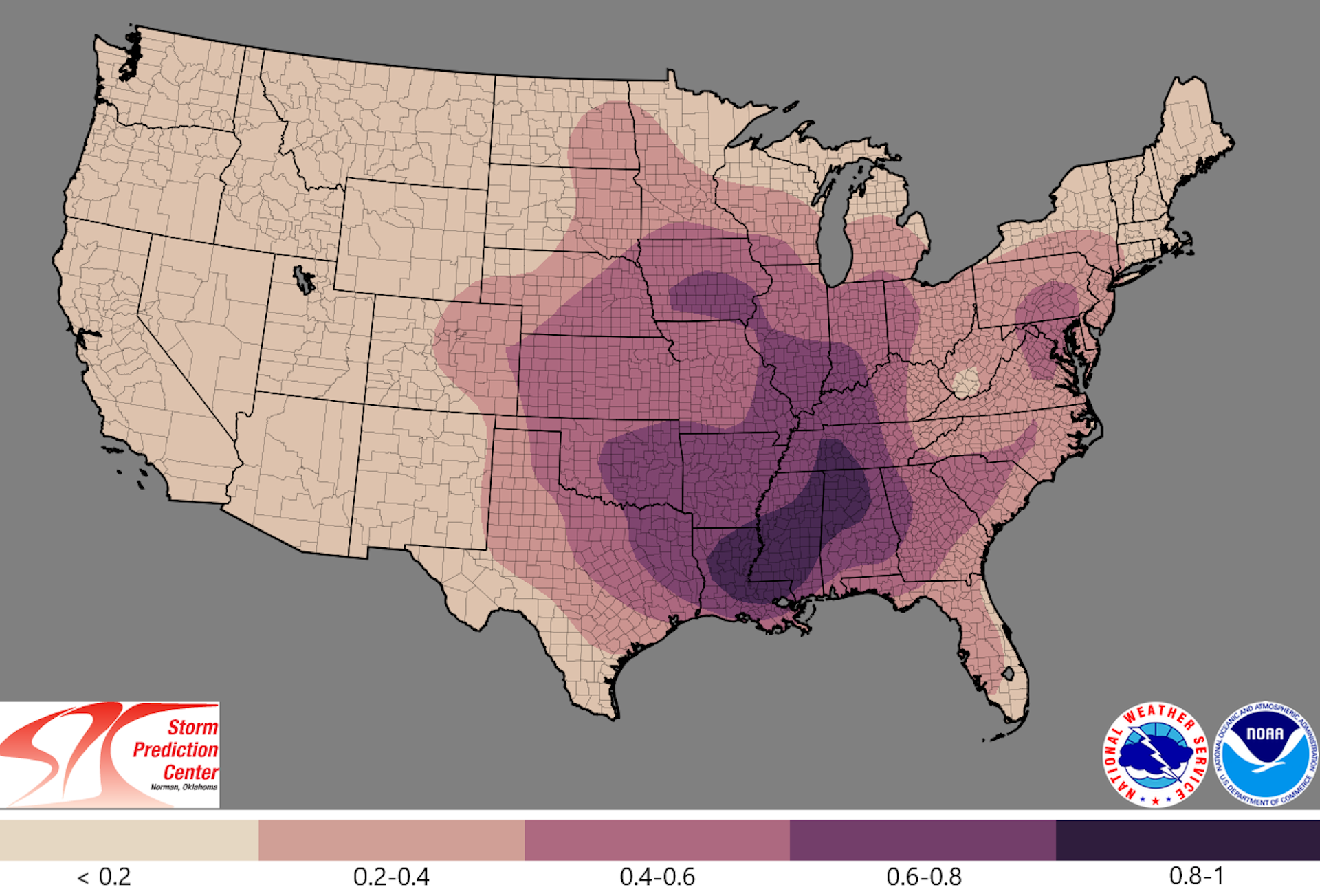
The U.S. experienced several multistate outbreaks in 2024. Tornadoes damaged homes from Texas to Minnesota and east to West Virginia and Georgia. They caused widespread destruction in several towns, including Greenfield, Iowa; Westmoreland, Kansas; and Bartlesville, Oklahoma. Barnsdall, Oklahoma, was hit twice in two months.
In May, at least one tornado occurred somewhere in the country almost every day.
What causes some years to have so many tornadoes? I’m a meteorologist who studies tornadoes and thunderstorms. Here’s what created the perfect conditions for these violent storms.
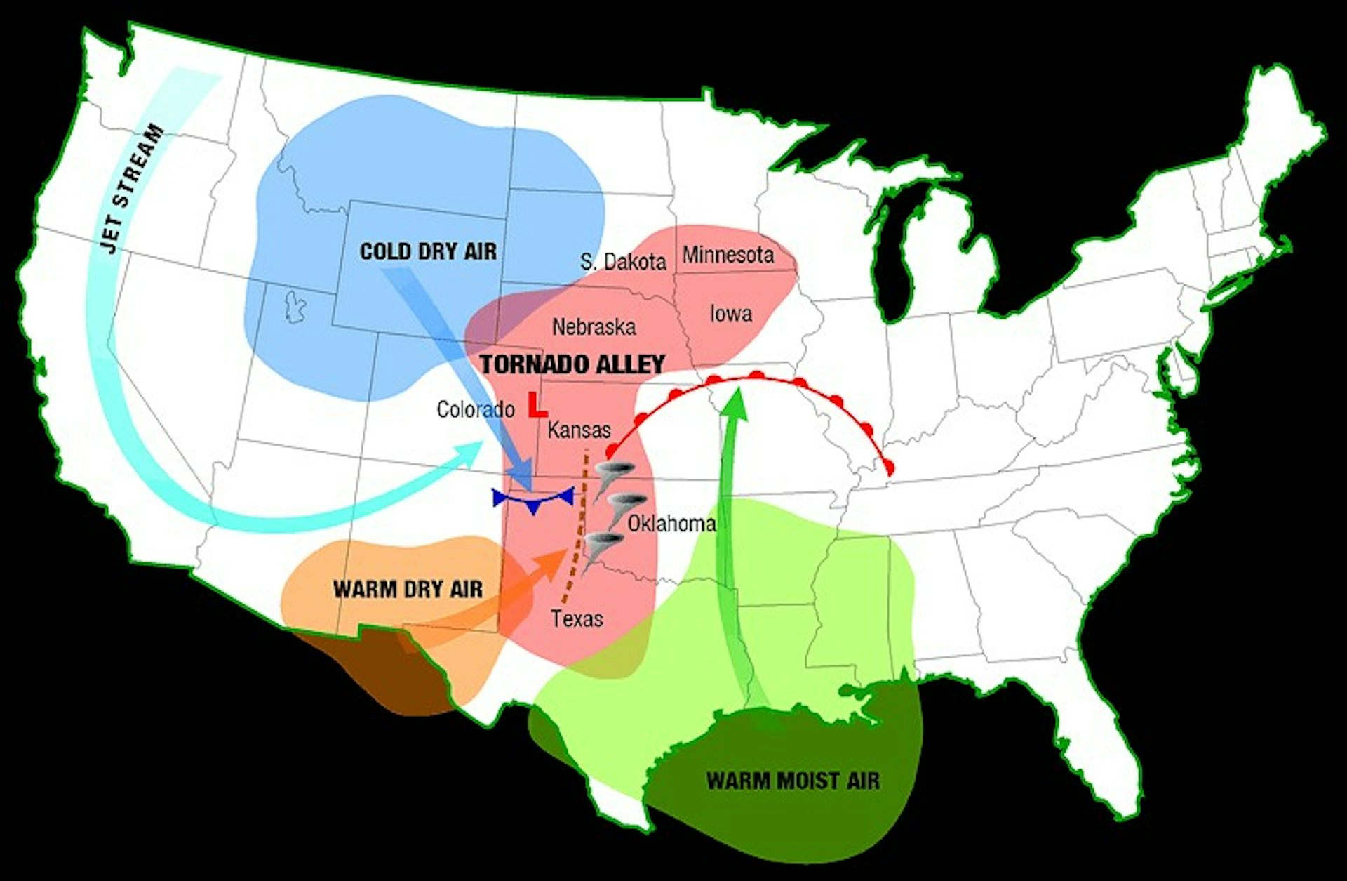
The hyperactive season has been due to an abundance of two key ingredients for tornadoes: wind shear and instability.
The jet stream − a band of strong upper-level winds that mostly blows west to east, flowing between warm air to its south and cool air to its north − plays an important role in how and where weather systems evolve, and in wind shear.
During April and May 2024, the jet stream often dipped southward in the western U.S. before turning back to the northeast across the Plains. That’s a pattern favorable for producing tornadoes in the central U.S.
In the area east of the jet stream’s southern dip, air rises. That creates a strong low-pressure system, which causes winds near the ground to blow from a different direction than winds higher up, contributing to wind shear.
Making this year even more active, persistent record heat waves were common over Mexico and Texas, while the Rockies and far northern United States stayed cool. The sharp temperature difference created a stronger jet stream than normal, leading to strong changes in wind speed with elevation. As a result, wind shear has been on steroids.
...continued


Comments