Current News
/ArcaMax

Trump says Russia has 10 more days to reach Ukraine truce
U.S. President Donald Trump said he would give Russia 10 more days from Tuesday to reach a truce with Ukraine, formally announcing a new deadline to pressure Vladimir Putin on ending the war.
“Ten days from today,” Trump told reporters aboard Air Force One on Tuesday as he returned to Washington from a five-day visit to Scotland.
Trump on...Read more
Park Avenue shooter Shane Tamura's claims put NFL's CTE problem in spotlight
NEW YORK — The NFL’s long history with CTE has come under new attention after Monday’s deadly shooting at the Manhattan office building that houses the league’s headquarters.
The gunman, identified as Shane Tamura, was said to be in possession of a note claiming he had CTE, a neurodegenerative disease, and that asked for his brain to be...Read more

NFL executive warned colleagues of NYC gunman after being shot in back, family says
NEW YORK — A brave NFL executive warned his colleagues there was an active shooter in their Park Avenue Midtown office building when he was shot and critically wounded in the lobby, his family told the Daily News.
“He was on his way home when he got shot,” wounded victim Craig Clementi’s father-in-law Robert Hunter said Tuesday morning....Read more
9-year-old girl identified after drowning death at Hersheypark
The 9-year-old girl who died at a water park in Hersheypark last week has been identified and her cause of death revealed.
Sophia Subedi died on Thursday while visiting The Boardwalk at Hersheypark, a family spokesperson told WGAL.
Subedi had been swimming in the wave pool when a lifeguard realized she was in distress and pulled her from the ...Read more

New York gunman, an LA high school football standout, left a note saying, 'Study my brain please'
Investigators are looking into whether a Las Vegas man who went on a deadly shooting rampage in Manhattan on Monday was targeting the National Football League after it emerged that the gunman was a Los Angeles high school football player with a documented mental health history.
New York Mayor Eric Adams said Tuesday that the shooter, identified...Read more

California, other states sue Trump administration over bill defunding Planned Parenthood
LOS ANGELES — California and a coalition of other liberal-led states sued the Trump administration Tuesday over a provision in the “Big Beautiful Bill” that bars Planned Parenthood and other large nonprofit abortion providers from receiving Medicaid funding for a host of unrelated health care services.
The measure has threatened clinics ...Read more

Florida has no formal hurricane plan for Alligator Alcatraz
MIAMI — After weeks of requests from politicians and media, the state of Florida said it has no formal, completed plan for how to handle a hurricane at Alligator Alcatraz, the new immigrant detention site in the heart of the Everglades.
Two weeks ago, the Miami Herald requested “the completed hurricane/disaster plan for Alligator Alcatraz�...Read more
Justice Department hits judge in El Salvador deportation case with ethics complaint
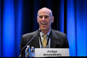
WASHINGTON — The U.S. Justice Department filed an ethics complaint accusing a federal judge in Washington of making “improper” comments about President Donald Trump earlier this year, ratcheting up growing tensions between the executive and judicial branches.
The misconduct claim against U.S. District Chief Judge James Boasberg was ...Read more

NYC shooting victims include police officer, Blackstone executive, 2 other workers
NEW YORK — A Blackstone executive, who was also a mother of two, and a heroic NYPD officer survived by his pregnant wife and sons were among the four people fatally shot inside a Midtown Manhattan skyscraper on Monday.
Gunfire erupted inside the Park Avenue office tower, which is owned by Rudin Management and houses offices for the NFL as ...Read more
Trump EPA moves to eliminate landmark scientific rule that's the basis for climate regulations
The Trump administration’s U.S. Environmental Protection Agency proposed on Tuesday revoking a science-based determination that pollution fueling climate change harms public health. The so-called endangerment finding has since 2009 underpinned federal regulations for vehicles, power plants and other sources under the Clean Air Act.
EPA ...Read more

Sean 'Diddy' Combs makes another bid at bond ahead of sentencing
NEW YORK — Sean “Diddy” Combs is making yet another bid at bail as the Harlem-born mogul awaits sentencing his Oct. 3 sentencing for two prostitution-related charges.
Lawyers for the 55-year-old convicted Bad Boy Records founder, who was recently denied presentencing bail, argue that he should be released on $50 million bond and reside at...Read more

Summer violence touches parking lot prayer site in Chicago: 'There is a different way'
CHICAGO -- Allen Hall hunched at a picnic table outside the University of Chicago Medical Center last week under the beating sun, his head in his hands.
A few days before, Hall’s 24-year-old daughter, Arneka McReynolds, had taken a special trip down to Chicago with her fiance from their home in Michigan to attend the Simeon Career Academy ...Read more

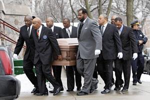
NYPD Officer Didarul Islam, victim of Park Avenue mass shooting, was a 'hard-working family man'
NEW YORK — Didarul Islam, the NYPD officer killed by a rampaging gunman in a mass shooting in a Park Avenue skyscraper, was a Bangladeshi immigrant who joined the force to leave behind a legacy his family could be proud of, mourners said Tuesday.
Islam, 36, a father of two with a baby on the way, was one of four people gunned down by Shane ...Read more

New York gunman, an LA high school football standout, may have been targeting NFL offices
Investigators are looking into whether a Las Vegas man who went on a deadly shooting rampage in Manhattan on Monday was targeting the National Football League after it emerged that the gunman was a Los Angeles high school football player with a documented mental health history.
New York Mayor Eric Adams said Tuesday that the shooter, identified...Read more

Harsh reality of US trade deal stirs EU soul-searching over lost clout
As European Union leaders work through the consequences of their new trading arrangement with the U.S., they are confronting the bitter reality of just how far they have fallen.
Donald Trump held court on Sunday at one of the golf courses he owns on the Scottish coast, touting the new ballroom he’d had built at the clubhouse and delivering a...Read more

A DACA recipient accidentally drove into Mexico. Now he's being fast-tracked for deportation
SAN DIEGO -- A rideshare driver allowed to live in the U.S. under a program for immigrants who arrived undocumented as children said that he mistakenly drove into Tijuana while transporting passengers near San Ysidro.
Now, Erick Alexander Hernández, a 34-year-old man originally from El Salvador, is in immigration custody in San Diego and being...Read more

Perseid meteor shower: When it peaks and what could spoil the party
LOS ANGELES -- When it comes to meteor showers, the Perseids pop. It's not just about the quantity of meteors (as many as 100 per hour) and their showy quality (fireballs!) but also their superb timing.
The annual shower hits its peak on warm, laid-back August nights as the Earth crosses paths with the dust cloud left by comet Swift-Tuttle on ...Read more
Israelis begin to question the morality of their war in Gaza
The news on Israel’s main TV channel had just finished a segment on how hunger in Gaza is portrayed around the world when the anchor looked up and said: “Maybe it’s finally time to acknowledge that this isn’t a public relations failure, but a moral one.”
Whether or not it was a Walter Cronkite moment, when the U.S. broadcaster ...Read more
Shane Tamura targeted NFL, suicide note blames CTE brain injury for NYC Park Ave. mass shooting
NEW YORK — Shane Tamura, the Park Avenue gunman who killed an NYPD officer and three others before taking his own life, left behind a suicide note saying he suffered from CTE, a brain injury often linked to playing football, and was targeting the NFL — but took the wrong elevator, officials said Tuesday.
Tamura, 27, who played competitive ...Read more

COVID rising in California. How bad will this summer be?
COVID-19 is once again on the rise in California.
It remains to be seen whether this latest uptick foreshadows the sort of misery seen last year — when the state was walloped by its worst summertime surge since 2022 — or proves fleeting. But officials and experts say it's nevertheless a reminder of the seasonal potency of the still-...Read more
Popular Stories
- Trump to set up Gaza 'food centers' to address 'real starvation'
- Republicans call Medicaid rife with fraudsters. This man sees no choice but to break the rules
- Brother of Walmart stabbing suspect says family tried to get him help for years
- COVID rising in California. How bad will this summer be?
- 5 dead, including NYPD officer, in shooting at Park Avenue skyscraper housing Blackstone Group and NFL headquarters


