Sierra snowpack sees promising start but California's water fortunes have 'a long way until April'
Published in News & Features
California’s first snowpack measurement of 2025 on Thursday showed promising figures for the water year, complemented by high storage levels in some of the state’s most critical reservoirs.
However, uneven snow distribution across the Sierra Nevada highlighted lingering concerns as the state moves into its peak precipitation season.
The Department of Water Resources reported that statewide snow water equivalent — considered a key measure of the snowpack’s water content — is at 110% of the average for this time of year.
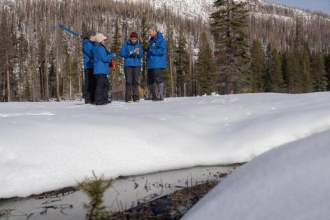
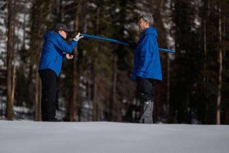
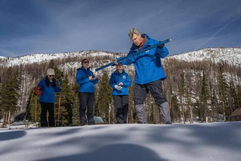
The findings collected from data sensors across the Sierra reinforced what was observed by the Department of Water Resources’ first survey of the water year at Phillips Station in El Dorado County. The measurement Thursday under blue skies on a blanket of snow at Phillips Station was encouraging at first — 24 inches of snow and 9 inches of water content; state Department of Water Resources monitors were excited to see how the storms that closed out 2024 translated to snowpack, said Andy Reising, manager of snow surveys for DWR.
But following the snow samples water officials remained concerned about the state of the Sierra snowpack and the prospect of more precipitation in early 2025.
“We’re doing great in the northern half. We’ve had that big atmospheric river series of storms in November and a few others in December,” Reising said. “So that’s a great start for the north, but the south is definitely under average,” adding that strengthening La Niña conditions could extend dry conditions south of Yosemite.
“As of right now, I’m feeling OK,” Reising continued, “but if we don’t get more storms, we’ll need a progression of monthly storms to keep going.”
The concern is borne out of the weather extremes that have whipsawed California in recent years: Punishing heat and dry conditions extending well into the fall, followed by intense rain like the series of atmospheric river systems that pummeled the state in November.
“While our snowpack looks good now, we have a long way until April when our water supply picture will be more complete,” said DWR Director Karla Nemeth, in a statement. “Extreme shifts between dry and wet conditions are continuing this winter and if the past several years are any indication, anything could happen between now and April and we need to be prepared.”
Nemeth and other water-watchers look to recent history. In 2013 and again in 2022, strong January snow surveys promised healthy water years only to see prolonged dry weather erase the early gains and continue drought conditions.
Last year, the state had only 28% of its average snowpack for this time of year. It was the worst start to a California wet year in a decade and a stark contrast to 2023, when record-setting rain and snow blanketed the state. That bumper crop followed a dry 2022 — the final year of a three-year stretch that was the driest on record in California.
Statewide, the snowpack’s snow water equivalent stands at 10.7 inches, 39% of the average state officials are expecting by April 1, when the snowpack typically reaches its peak and serves as a vital water source during the state’s dry summer months.
Reising said the precipitation the state has received to date was 115% of average, with stronger figures in the northern portions of California’s watershed.
The northern Sierra and Trinity region, which covers the Sacramento and Feather watersheds, reported the strongest snowpack conditions, with snow water equivalent at 161% of the average for early January and 57% of the April 1 average.
In the Central Sierra region, which measured 94% of the normal for this date but only 35% of the April goal.
The Southern Sierra lagged significantly, with snow water content at 75% of the January norm and 27% of April’s average.
“There’s been quite a gradient in the amount of precipitation in California from north to south,” he said. “So far this year, for snow on this date, the northern region is above 160%. ... The (Interstate) 80 corridor got a ton of snow with those atmospheric rivers, but it was less and less as we moved south through the state.”
The snowpack provides about 30% of California’s water supply, replenishing reservoirs that support agricultural irrigation and urban water demands. This year’s strong start is a welcome reprieve following recent years of water shortages and below-average precipitation.
The Sierra snowpack plays a critical role in California’s water supply infrastructure. As snow melts in the spring, it feeds rivers, reservoirs, and aqueducts that deliver water to millions of residents.
Shasta Lake, the federal reservoir that is the state’s largest, is currently at 77% of its total capacity and 130% of its historical average for this time of year. Oroville, which feeds the State Water Project, is at 68% of capacity and 126% of its historical average. Closer to home, Folsom Lake currently stands at 37% of capacity, or 89% of its historical average.
Experts attributed the uneven snowpack across the Sierra to the pattern of winter storms that have brought heavier precipitation to the northern regions while leaving central and southern areas drier than usual.
Northern stations measured an average snow water equivalent of 15.9 inches, while the central Sierra recorded just 10 inches. The southern Sierra, which often relies on late-season storms, posted an average of only 6.2 inches.
That uneven precipitation is mirrored in the latest Drought Monitor report from the University of Nebraska-Lincoln, which showed drought conditions persisting across much of California — 59.1% of the state is experiencing some level of drought, a slight increase from 56.5% one week ago. Still, severe drought is only affecting around 6% of the state, mainly in the fringes of the Colorado River basin.
_____
©2025 The Sacramento Bee. Visit sacbee.com. Distributed by Tribune Content Agency, LLC.


Comments