Why doesn't California get hurricanes?
Published in News & Features
Over the past two weeks, two massive hurricanes have killed more than 240 people and caused tens of billions of dollars of damage in Florida, Georgia, North Carolina and other states.
California struggles every year with plenty of disasters — including devastating earthquakes, wildfires and floods. But it doesn’t have hurricanes. Why not?
Experts said Thursday it mostly comes down to two words: water temperature.
“Warm tropical ocean waters are hurricane fuel. We don’t have that in California,” said Daniel Swain, a climate scientist at the University of California, Los Angeles. “Not even close.”
On Thursday afternoon, the water temperature in the Gulf of Mexico off Tampa, Florida where Hurricane Milton slammed ashore the night before, was 81 degrees. It was 84 in the middle of the Gulf.
But in San Francisco off the Golden Gate Bridge on Thursday, the Pacific Ocean was just 58 degrees. Off Monterey it was 61. Santa Barbara 63. And San Diego 64.
“The water temperatures in the Gulf and in the Atlantic are up to 30 degrees warmer than they are on our coast,” said Jan Null, a meteorologist with Golden Gate Weather Services in Half Moon Bay. “And it’s the heat from the oceans gives hurricanes their strength.”
Hurricanes are massive tropical storms. They produce heavy rainfall and extreme winds.
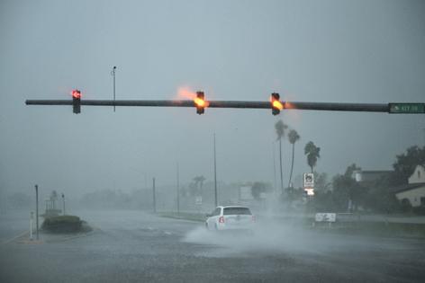
Tampa received a staggering 11 inches of rain in a 24-hour period Wednesday and Thursday — more than its monthly average for October. By comparison, San Jose has received 17 inches over the entire past year. At its peak, Milton was a category 5 hurricane with winds up to 180 mph. During California’s biggest winter storms, sustained winds rarely exceed 40 miles an hour.
Large atmospheric river storms in California don’t bring punishing winds, but they can bring huge amounts of water, which not only fill reservoirs, but also can cause flooding. Yet hurricanes are more explosive.
Why does warm water matter? Hurricanes form when warm, moist air mixes with warm ocean waters, usually waters that are 80 degrees Fahrenheit or hotter.
Winds push the humid air upward, creating low pressure. The humid air cools as it rises, forming clouds and thunderstorms. The storms begin spinning with the rotation of the Earth, increasing speed as they they pull in more water vapor and heat. When the winds reach a sustained speed of 74 mph or greater, they are categorized as hurricanes.
Many hurricanes stay harmlessly out in the ocean. When they hit land, they slow down, losing energy, and break up. But with immense momentum, they can cause devastating damage.
Hurricane Helene, a category 4 storm with winds up to 140 mph that came ashore Sept. 28, ravaging through Northern Florida, Georgia, North Carolina and Tennessee, killed at least 232 people and caused more than $38 billion damage, as of Thursday, authorities said.
Helene is the deadliest hurricane to hit the United States since Katrina devastated New Orleans in 2005.
The Pacific Ocean off California remains much cooler because of the California Current, a slow-moving massive flow of water that travels from Canada down the West Coast to Mexico. It is fueled by upwelling, when winds push surface water away from the coastline, causing colder water to rise up from below, which also brings nutrients for sardines, anchovies, squid and other marine life.
The opposite happens on the East Coast. There, the Gulf Stream moves south to north, bringing warm water into the Gulf of Mexico and up the Atlantic Coast.
“They have a perfect recipe for hurricanes there,” Null said. “We have the polar opposite.”
Could climate change eventually bring hurricane risk to California?
Not likely, said Swain. Most climate models show an increase in Pacific Ocean temperatures of 5 degrees or less over the next century.
“That still isn’t enough to sustain full fledged hurricanes,” Swain said. “We are probably never going to see a major hurricane making landfall in California. There just isn’t warm enough water. But it might mean that it will be easier for hurricanes not to completely fall apart before they hit Southern California.”
That happened last year.
Hurricane Hilary, a category 4 hurricane off southern Mexico, moved north in August 2023, eventually slowing into a tropical storm as it neared Southern California.
Some mountain areas in Southern California received 10 inches of rain. There were mudslides, floods, and $900 million in damage with three deaths in California and Mexico. Downtown Los Angeles and San Diego each received 2.48 and 2.99 inches, breaking all-time daily records.
There is only one recorded example of a hurricane potentially making landfall in California. That occurred in San Diego in 1858. Scientists have reassembled weather records, including barometer readings, from the U.S. Army hospital in San Diego, and from local newspaper accounts, and concluded it probably was a modest hurricane.
Other far-away hurricanes have caused different problems, however. In August 2020, Tropical Storm Fausto, which began off Mexico, sent moisture northward to California. It wasn’t enough to cause rain. But it did trigger dry lightning that sparked 367 wildfires in California that killed 20 people and burned more than 1.8 million acres, including in the SCU Lightning Complex, August Complex, CZU Lightning Complex, and North Complex fires.
Swain said that lightning risk, and the fact that warmer temperatures mean atmospheric river and tropical storms can carry more water, is something that scientists need to further study.
“It’s very clear that we are going to see more extreme rainfall and flood risk,” he said. “It’s looming large in California in ways that people aren’t really ready for.”
©2024 MediaNews Group, Inc. Visit at mercurynews.com. Distributed by Tribune Content Agency, LLC.


Comments