Hurricane Beryl’s rapid intensification was alarming: Here’s why more tropical storms are exploding in strength
Published in News & Features
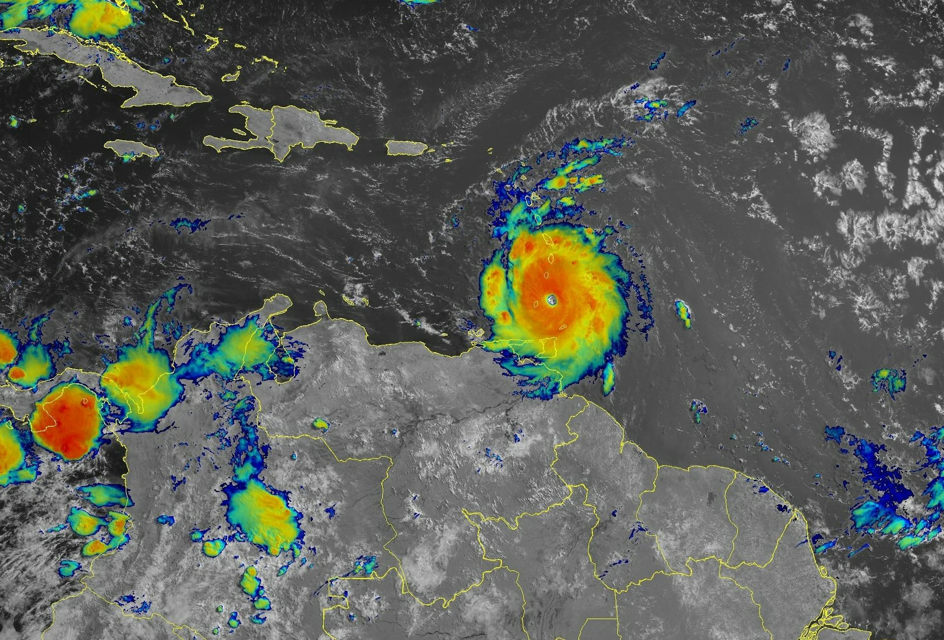
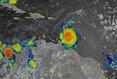

Hurricane Beryl was the latest Atlantic storm to rapidly intensify, growing quickly from a tropical storm into the strongest June hurricane on record in the Atlantic. It hit the Grenadine Islands with 150 mph winds and a destructive storm surge on July 1, 2024, then continued to intensify into the basin’s earliest Category 5 storm on record.
The damage Beryl caused, particularly on Carriacou and Petite Martinique, was extensive, Grenada Prime Minister Dickon Mitchell told a news briefing. “In half an hour, Carriacou was flattened.”
Beryl’s strength and rapid intensification were unusual for a storm so early in the season. This year, that is especially alarming as forecasters expect an exceptionally active Atlantic hurricane season.
Rapidly intensifying storms can put coastal communities in great danger and leave lasting scars. In 2022, for example, Hurricane Ian devastated portions of Florida after it rapidly intensified. To this day, residents are still recovering from the effects. As Beryl continued to intensify on a path across the Caribbean Sea on July 2, Jamaica was under a hurricane warning and other islands, including Grand Cayman, were under watches.
What causes hurricanes to rapidly intensify, and has climate change made rapid intensification more likely?
I research hurricanes, including how they form and what causes them to intensify, and am part of an initiative sponsored by the U.S. Office of Naval Research to better understand rapid intensification. I also work with scientists at the National Atmospheric and Oceanic Administration to analyze data collected by reconnaissance aircraft that fly into hurricanes. Here’s what we’re learning.
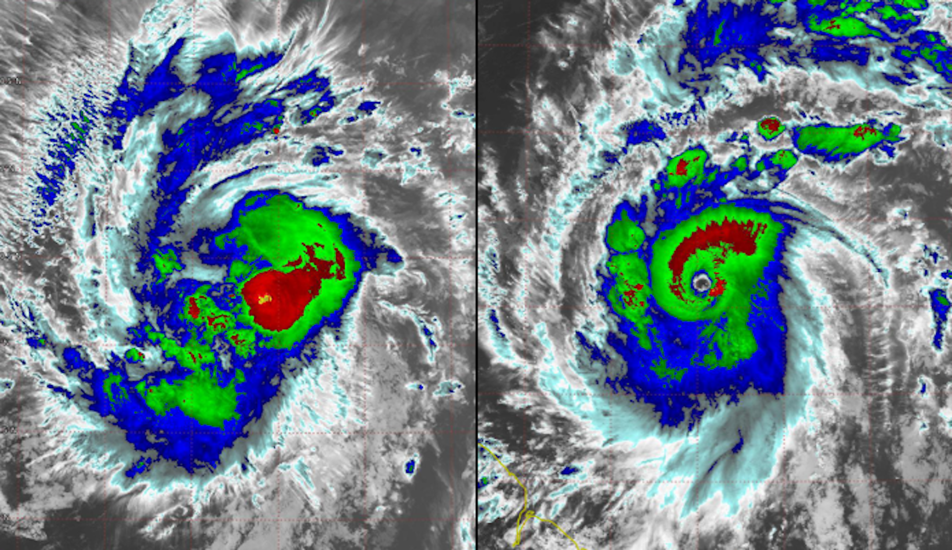
Rapid intensification occurs when a hurricane’s intensity increases by at least 35 mph over a 24-hour period. Beryl far exceeded that threshold, jumping from tropical storm strength, at 70 mph, to major hurricane strength, at 130 mph, in 24 hours.
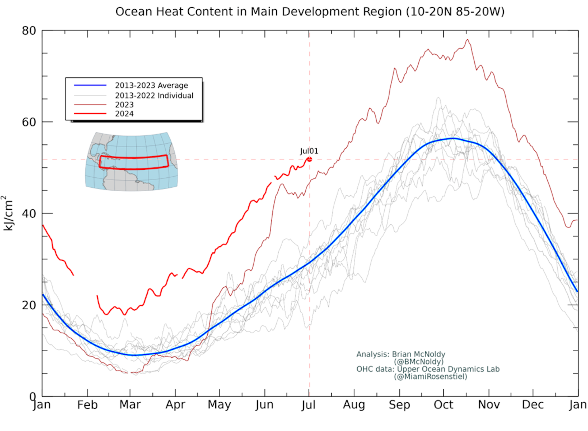
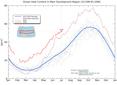
A key ingredient for rapid intensification is warm water. The ocean temperature must be greater than 80 degrees Fahrenheit (27 Celsius) extending more than 150 feet below the surface. This reservoir of warm water provides the energy necessary to turbocharge a hurricane.
Scientists measure this reservoir of energy as ocean heat content. The ocean heat content leading up to Beryl was already extraordinarily high compared with past years. Normally, ocean heat content in the tropical Atlantic doesn’t reach such high levels until early September, which is when hurricane season typically peaks in activity.
Beryl is a storm more typical of the heart of hurricane season than of June, and its rapid intensification and strength have likely been driven by these unusually warm waters.
...continued


Comments