From Mammoth to Tahoe, powerful blizzard could sock Sierra with up to 12 feet of snow
Published in Weather News
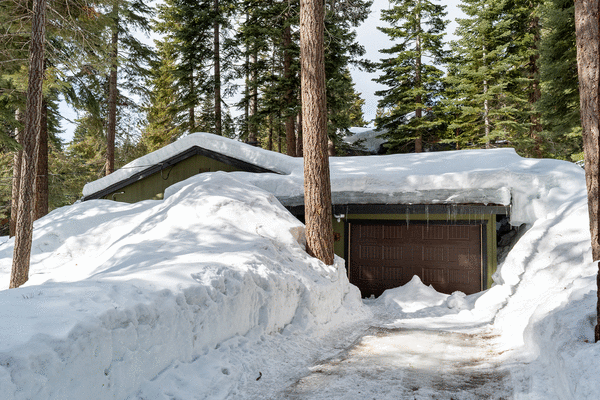
A powerful storm taking aim at California starting Thursday could bring the strongest blizzard of the winter for the Sierra Nevada, potentially dumping 5 to 12 feet of snow at elevations 5,000 feet above sea level.
"Even by Sierra standards, this is shaping up to be a highly impactful, major winter storm," the National Weather Service office in Reno said. "If these snow totals hold, this will easily be the biggest storm of the season."
That includes the possibility of 1 to 3 feet of snow for communities along Highway 395 in Mono County, with Mammoth Lakes and June Lakes potentially getting nearly 4 feet of snow. There's a strong chance of 4 feet of snow along the Sierra crest around the Tahoe Basin, and more than 3 feet in places like South Lake Tahoe, Incline Village and Tahoe City, forecasters said.
Winds on the ridge tops of California's mightiest mountain range "could easily exceed 120 mph," and "could lead to blizzard conditions with near-zero visibility at times."
Forecasters urged people to take advantage of calm weather through Wednesday to prepare ahead of the incoming storm. They warned travel is expected to be nearly impossible from about 4 a.m. Thursday through Sunday morning. "If you attempt to travel, be prepared for whiteout conditions & extended road closures. Bring extra food, water, & warm clothing," the National Weather Service office in Sacramento posted on social media.
Yosemite Valley could see snow showers on Saturday, the weather service office in Hanford said. "Snow may be heavy at times."
For Los Angeles County, the storm is expected to bring a slight chance of rain late Friday, becoming likely on Saturday and possibly lasting through Sunday morning.
That storm could bring 0.75 to 1.5 inches of rain to the coast and valleys, and 1 to 3 inches in the mountains. But there's also the possibly of a more dry scenario, with as little as 0.25 to 0.5 inches of rain in the coast and valleys, and 0.5 to 1 inch of rain in the mountains.
The weekend storm will be a cold one for L.A. County; there could be a dusting of snow in some areas at elevations below 3,000 feet. "This will likely be the coldest air mass we've had in some time with frost/freeze concerns possible for sheltered valleys Sunday and possibly a bit more widespread into Monday morning," the weather service office in Oxnard said.
Rain could return to the San Francisco Bay Area starting late Thursday and continue through Saturday.
"Overall it's just going to be nasty outside, with cold temperatures, gusty wind and periods of moderate rain," the National Weather Service office in Monterey said. "That being said, the actual impacts look mostly minor with wind gusts in the 25-35 mph range and only a moderate amount of rainfall, spread out over a few days."
Winds could be a problem in the Sacramento Valley. Forecasters warned of winds gusting from 35 to 55 mph that could trigger power outages, especially from Marysville in Yuba County and northward.
_____
©2024 Los Angeles Times. Visit latimes.com. Distributed by Tribune Content Agency, LLC.


Comments